
Physical Planning, Environmental & Land Development Consultants in Kenya
We help County Governments, developers, institutions and landowners secure approvals, plan sustainable projects and maximise land value — from master plans to NEMA licenses.
Trusted partners
Counties, institutions and industry leaders trust our work


What we do
Integrated services for land, planning and the environment
Urban Planning
We design resilient, productive urban environments — integrating land use, transport, housing and infrastructure for cities that work.
Learn morePhysical Planning
Registered physical planners preparing development plans, zoning, and securing approvals under the Physical and Land Use Planning Act.
Learn moreEnvironmental Impact Assessment (EIA)
NEMA-approved EIA experts. We manage screening, scoping, study, reporting and licensing — end to end.
Learn moreMaster Plans
Long-term, visionary master plans for counties, cities, universities and large-scale private developments.
Learn moreLand Change of Use
End-to-end Land Change of User applications — from feasibility through Liaison Committee approval.
Learn moreGeospatial Technologies
GIS, remote sensing, drone surveys and spatial data analysis — mapping for smart, evidence-based decisions.
Learn moreLand Subdivision
Subdivide land into sellable plots — feasibility, scheme design, liaison, surveying and title processing.
Learn more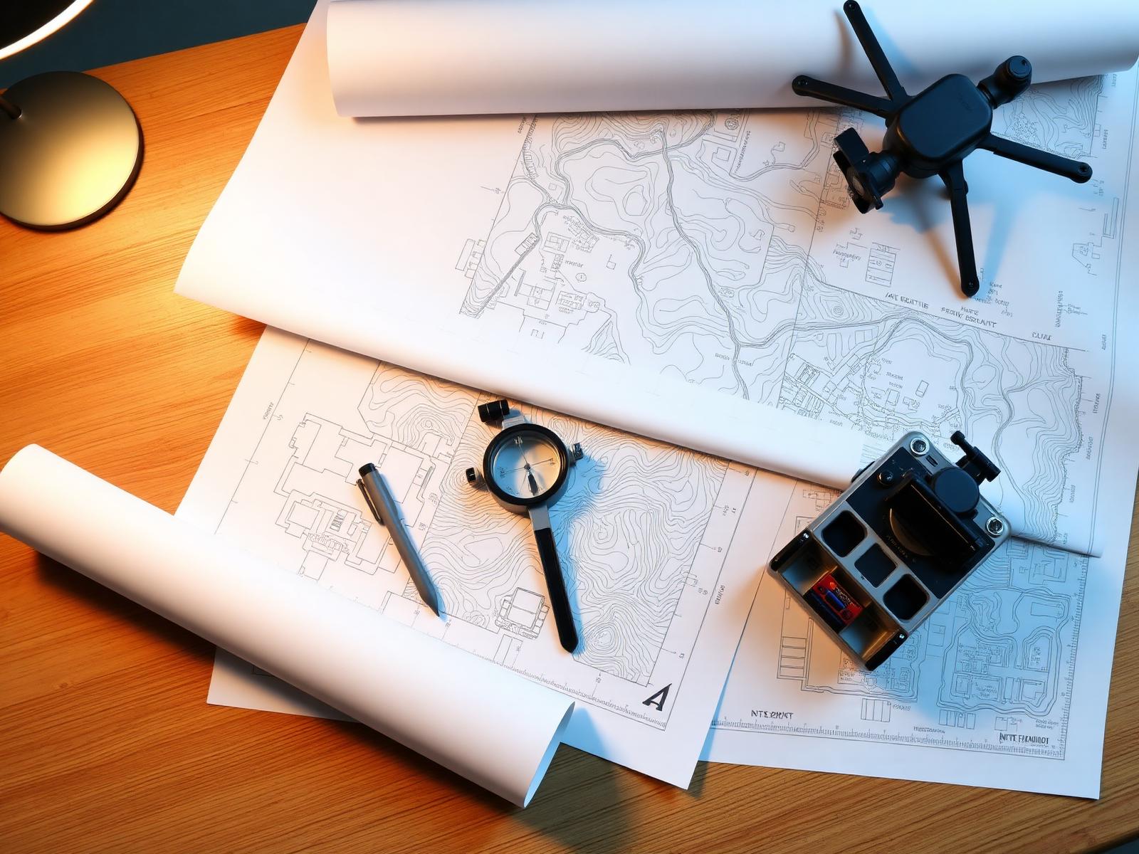
About the firm
A Kenyan consultancy built on professionalism, science and stewardship
Turning Point Consultants Ltd is a Kenyan-owned firm offering professional services in planning, development and management of land. Our team combines wide-ranging experience in geospatial surveying, urban & regional planning and environmental management — gained both locally and internationally.
- Sustainability
- Professionalism
- Innovation
- Client Focus
- Excellence
- Regulatory Rigor
 Featured Project
Master plan
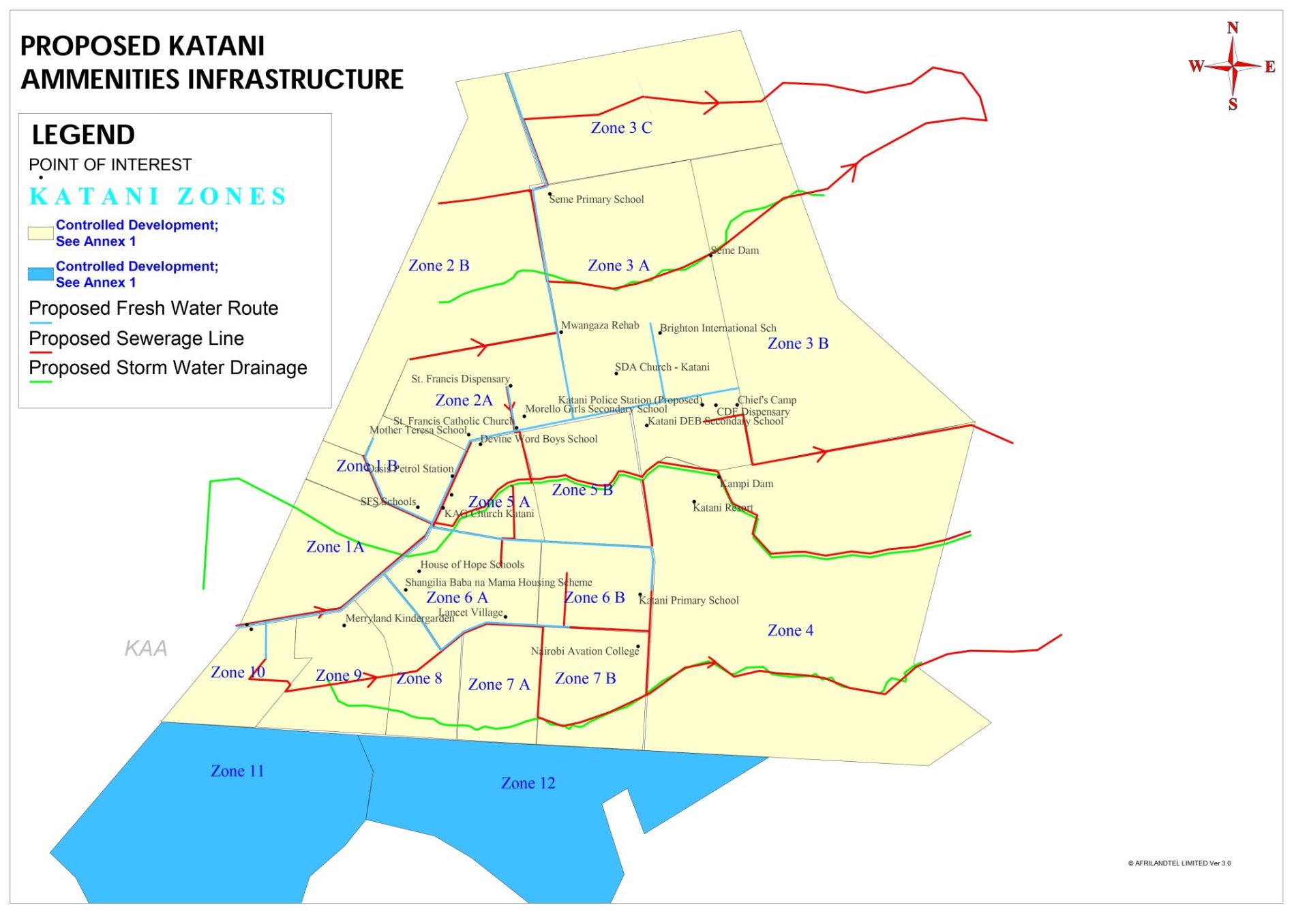
Katani Amenities Infrastructure Plan
Zoning, fresh water routes, sewerage and storm-water drainage across 12 Katani zones — designed to support controlled, sustainable growth.
- 12 development zones mapped
- Fresh water & sewer reticulation
- Storm-water drainage network
- Points of interest indexed
Who we serve
Industries we work with
Geospatial intelligence
Smart planning, powered by location data
GIS mapping, remote sensing, drone surveys and spatial analysis — turning data into decisions for counties, developers and investors across Kenya.
Explore GIS servicesSustainability
Plans that respect land, water and community
From solar-ready rooftops to storm-water harvesting and green corridors — every plan we produce is designed to age well in the Kenyan climate and economy.
Our EIA practice
Company brochure
Download our profile & service brochure
A concise PDF covering our services, registrations, completed projects and the team behind Turning Point Consultants Ltd.
- PDF · A4
- Updated 2025
Voices of trust
What our clients say
"Working with Turning Point was a game-changer for our community. They listened, involved us at every step, and the final plan reflected our aspirations."
"We engaged them for an EIA on a major infrastructure project. Thorough, professional, on time, and a report that secured our NEMA license."
"The comprehensive land use plan they delivered optimised our land and ensured full regulatory compliance. Highly recommended."
"Their GIS team produced detailed, accurate maps that were crucial for our project. Modern technology and real insight."
"End-to-end support managing and selling our plots — valuation, marketing, sales. Outcomes beyond what we expected."
"Reliable partner for spatial planning. Their work withstands review and supports decision-making in our county."
FAQ
Frequently asked questions
Quick answers on EIA, subdivision, change of user, master plans and more — for the Kenyan context.
How much does an EIA cost in Kenya?+
It depends on the project type, scale and location. EIA Project Reports start lower than full EIA Studies. Contact us for a tailored quotation.
How long does land subdivision take?+
Typically 6–12 months end-to-end, depending on county, scheme size and surveying timelines.
What is the process for change of user?+
Site appraisal → document preparation → Liaison Committee submission → public notice → review → approval and gazettement.
When is a NEMA license required?+
For projects listed under the Second Schedule of EMCA — most construction, industrial, infrastructure and waste-handling projects.
What does a physical planner do?+
Prepares spatial plans, advises on land use and zoning, and secures planning approvals on your behalf.
How much does a master plan cost?+
Master plans are scoped by area, complexity and stakeholder reach. Share a project brief and we'll prepare a transparent proposal.
Ready to plan your next project with confidence?
Talk to a registered physical planner and NEMA Lead Expert today.